Blog · 13 October 2026
What is a tank stand in rural water supply infrastructure?
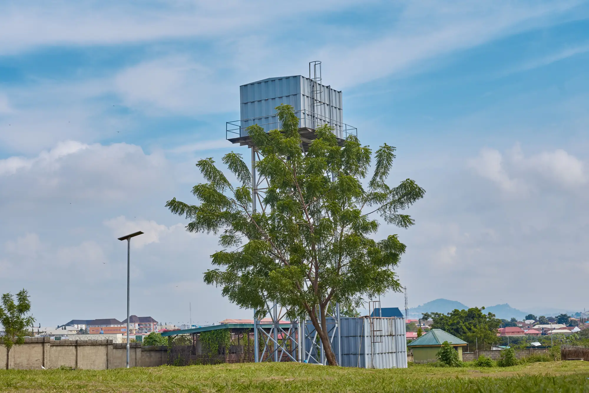
A tank stand is the elevated structure that holds a water storage tank above ground, high enough that gravity does the work of pushing water out to taps, standpipes, or a reticulation line without a pump running the whole time. In a gravity-fed scheme off a spring or borehole, the stand is often the only thing standing between "water reaches the household" and "water sits in a tank at ground level going nowhere."
Most rural schemes you'll see on a district inventory use one of three designs: a masonry tower (brick or stone, plastered, usually the sturdiest and the one that survives decades with no maintenance), a steel tower (angle-iron or tubular frame, faster to build, needs paint and bolt checks every few years), or a timber or bamboo platform (cheapest, shortest lifespan, common on small community schemes with tight budgets). Height is set by the pressure you need at the farthest tap, not by how tall someone thought it should look. A stand feeding a standpipe fifty meters away on flat ground needs far less head than one feeding a reticulated network across a ridge.
Why height and placement matter for coverage
The stand's job is pressure, not storage. The tank up top does the storing. The stand's height determines how far downhill that stored water can travel before pressure drops too low to be usable. Get the siting wrong, and you end up with a scheme that technically has a tank and a tap but delivers a trickle at the last fifty meters of pipe. That's the kind of thing a programme officer finds out three months after handover, usually from a community complaint, not from a design review.
This is also why tank stands cluster where you'd expect: near a borehole headworks, at the high point of a gravity catchment, or at a transition point between a trunk main and a distribution branch. If you're trying to work out which parts of a district already have infrastructure and which don't, elevated tank stands are one of the more reliable things to look for, because they're tall, they cast a shadow, and they don't move.
Reading a tank stand from an inventory or an aerial view
When a tank stand shows up on a district inventory, you want it dated and located, so you can tell a live site from one that stopped working years ago. A structure that was functional two years ago and a structure that's standing but dry and unused can look identical on a list. They don't look identical on current imagery: a stand with a full tank often has visible drip staining or a wet patch at the base from overflow, a maintained apron, and a footpath worn in from community use. A stand that's been abandoned shows none of that. None of this replaces a field visit to confirm the tap works, but it's the difference between sending a team to forty sites because nobody's sure which ones are live, and sending them to the dozen that actually need a look.
That's the gap Sanitation Mapping is built for: turning one annual high-resolution pass over your district into a dated, located point for every tank stand, borehole, and latrine block that shows up, exportable as GeoJSON or CSV so it drops straight into whatever GIS or spreadsheet your team already uses. It won't tell you if the pump is broken. It will tell you where to send someone to find out.
If a tank stand design review or a coverage gap analysis is next on your list, see how a single annual pass turns into a point inventory for your whole district.